VAAC London Quantitative Volcanic Ash 1.0

Abstract

The Quantitative Volcanic Ash information service provided by the London Volcanic Ash Advisory Centre supplies meteorological gridded data and spatial polygon data in response to tailored API requests submitted by an end user. Data is provided under the remit of the International Civil Aviation Organisation (ICAO) and in accordance with ICAO Annex 3 – Meteorological Service for International Air Navigation and ICAO Doc 10157 PANS-MET – Procedures for Air Navigation Services – Meteorology.

Applications:

  • Volcanic ash hazard awareness and avoidance, for eruptions in the VAAC London area of responsibility (primarily Iceland);
  • Predicting dosages of Volcanic Ash for aircraft engine and airframe service scheduling.

Forecast data is available to download per unique volcanic eruption (for significant ash eruptions only) from two API endpoints, and organised in three collections:

1. The VAAC London QVA Gridded Data API provides two collections in netCDF format:

  • The probabilistic collection forecasts the likelihood of ash concentration exceeding four set thresholds in mg/m3: ≥0.2, ≥2.0, ≥5.0 and ≥10.0. It includes four separate datasets (one per threshold).
  • The deterministic collection forecasts the expected ash concentration as a deterministic gridded forecast for a specific timestep. It includes one dataset.

2. The VAAC London QVA Products API provides the ash polygon features in XML format as per the QVA IWXXM schema. Data consists of sets of polygons that represent the ash concentration when it exceeds each of the four following four thresholds in mg/m3: ≥0.2, ≥2.0, ≥5.0 and ≥10.0, where the ash plume is present in the atmospheric layer between FL000 and FL600. This collection has one dataset.

In addition, users can subscribe to receive notifications when new payloads are ready to collect from the APIs. Notifications are filtered based on 'topics’ to which they have subscribed.

Key features:

  • Adheres to the EUROCONTROL Technical Infrastructure Yellow Profile and the OGC-EDR framework.
  • Gridded data is accessible through its own API endpoints; IWXXM data is available through its own, separate API endpoints.
  • Metadata in JSON format at collection level relating to the description and operation of the APIs.
  • Both APIs can handle multiple different erupting volcanoes simultaneously, and each volcano is listed as a unique location within each collection.
  • Only the most recently published set of data for each volcano is available through the APIs.
  • Published data covers the period T+0 to T+24 at 3-hourly intervals.
  • 0.25-degree horizontal resolution gridded data sets. Gridded data is provided as 5000ft thick horizontal slices for FLs: 000-050, 050-100, 100-150, 150-200, 200-250, 250-300, 300-350, 350-400, 400-450, 450-500, 500-550, 550-600. 
  • IWXXM data includes vertical levels where the ash plume is present in the atmospheric layer between FL000 and FL600. 
  • Forecasts encompass the entire ash plume, however large and wherever it extends, for volcanic eruptions in the VAAC London area of responsibility (Iceland).

In the event of operational issues, from December 2025 the VAAC Toulouse Quantitative Volcanic Ash API service operated by Météo-France will provide backup.

The QVA service is available from 28 July 2025 for testing and set up, and for operational use from 27 November 2025.

Service Type
SWIM_COMPLIANT
Life Cycle
Business Activity Type
AIRSPACE_ORGANISATION_AND_MANAGEMENT
Intended Consumer
AERONAUTICAL_INFORMATION_SERVICE_PROVIDER
AIR_TRAFFIC_SERVICE_PROVIDER
CIVIL_AIR_NAVIGATION_SERVICE_PROVIDER
CIVIL_AIRSPACE_USER
NETWORK_MANAGER
PROVIDER_OF_DATA_SERVICES
REGULATED_METEOROLOGICAL_SERVICE_PROVIDER
Information Exchange Category
AERONAUTICAL_INFORMATION_EXCHANGE
METEOROLOGICAL_INFORMATION_EXCHANGE
Application Message Exchange Pattern Entity
State ICAO Nationality Letters
EGRR
ICAO Region
EUR
In-Operation Date
28-Jul-2025
Provider
Met Office

The Met Office is the sole Air Navigation Service Provider (ANSP) certificated by the UK Civil Aviation Authority to provide and disseminate a range of aviation forecast products and services, in accordance with ICAO Annex 3 to the Chicago Convention, Meteorological Service for international Air Navigation.

ICAO’s Annex 3 provides the main regulatory framework against which the UK is obliged to provide meteorological services, and which the Met Office delivers Met Services against. This ensures that the UK meets its obligations to ICAO to provide safe, efficient and regular air travel.

These services fall into the following main categories:

a) UK services.

b) The World Area Forecast System (WAFS), as provided by World Area Forecast Centre (WAFC) London, in coordination with WAFC Washington.

c) SADIS (Secure Aviation Data Information Service).

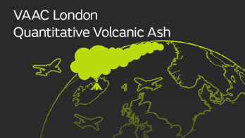
d) The Volcanic Ash Advisory Centre (VAAC) London.

In addition to the ICAO Annex 3 determined services, a range of discretionary services that are determined as a requirement in the UK are also provided. Specific services such as Aviation R&D and the provision of information to NATS are examples of this.

Provider Type
REGULATED_METEOROLOGICAL_SERVICE_PROVIDER
Support

To report incidents on services in operation, contact the 24/7 Weather Desk at [email protected] or +44 330 135 0000

Revision Save Date
Thu, 11/27/2025 - 10:55
Schema version
v2